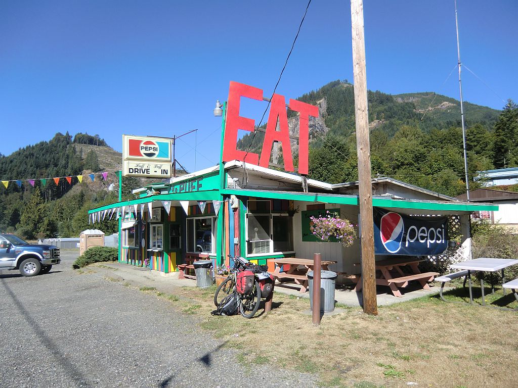
Detour Part II from the Pacific Coastal Route. It takes me roughly half a day to get out of Seattle on small highways paralleling the Interstate 5 (which is no fun nor legal to cycle). Eatonville, a neat town, after which the road gets less and less busy. Into the wild. Endless woods along the hilly road, and beautiful lakes and dams on the way. The overcast prevents any sights of Mt. Rainier, the biggest mountain of Washington. Passing through Elbe, a small logging village with German roots, a neat historic railway and the smallest church in the United States, dating back some 100 years ago. Mt. Rainier would be visible from here if there was no overcast, says a Restaurant lady. A few more miles in a neat valley towards Morton. A local at the supermarket recommends free camping on Riffe Lake nearby Glenoma. Getting there, have a blackberry diner and a good swim at sunset. A few hang gliders and a young guy that recovered from cancer but got homeless after hang out here.
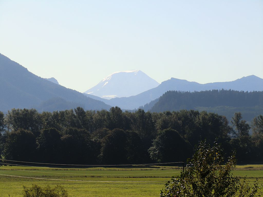
Perfect weather on the next day. Big breakfast in Randle - last chance of shopping for the next 100 kilometers. I take off to the pass behind Mt. St. Helens, the volcano which blew back in 1980. After the first few miles of climbing, an exiting view towards the snow caped Mt. Rainier opens up - majestic! After about 30 kilometers of climbing, I expect to reach the summit of the pass soon, and take a scenic side route towards Mt. St. Helens base camp. Just for half an hour, I convince my self. Just to see the volcano that blew. Centimeter thick light grey ash grains between the conifers and shrubs and ferns tell a story of its own. Crazy climbing up, I hide the panniers and the tent bag on the side of the road. Eventually, I reach Bear Meadow and enjoy a splendid outlook on Mt. St. Helens!
{youtube}CWjQYtX0Wyo{/youtube}
Its a few more miles than expected until I reach the summit of the pass at Milestone 35. Running out of water and out of granola bars. Still, it's an uneasy up and down for another 10 kilometers before the long downhill. The miles written in my map don't match the miles on the road signs. Finally a spring on the side of the road. 5PM - I reach the very junction and have to make a decision - go 20 miles to Cougar and probably find a shop and a campground until dusk, or go South towards Carson, another 40 miles through the next mountain range. I went on to Cougar, and skipped the opportunity to see the famous Columbia river gorge. On the next day, I cycle East to the Woodland, and then up North on the Interstate 5 along the Columbia river to Longview, speeding in the slipstream of the roaring trucks, without any small side road... More relaxed for the rest of the day until Cathlamet. Free camping and a swim in the river. In the East, the snow on Mt. St. Helens glows red in the light of a marvelous sunset. The campground hosts spoil me with potato salad and bread and home made cookies. God bless you!